|
Pachetul include:

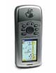
-Dispozitiv GPSMAP® 76CSx
-Card microSD de 128 MB
-Cablu interfaţă USB
-CD MapSource® pentru călătorii şi gestionare puncte intermediare
-Manual de utilizare
Nota:
>Pretul cu Ro.a.d. 200x preincarcat – upgrade-urile ulterioare se vor face contracost, detalii la www.romaniadigitala.ro si puteti trece oricand dupa aceasta la o licenta de ROAD200x full CD achitand doar diferenta de pret.
>Pretul cu Ro.a.d. 200x, CD Full – upgrade-urile ulterioare sunt GRATUITE pe toata durata de viata a aparatului.
|
| |
Specificatii
*Waypoint/icons: 1000 with name and graphic symbol, 10 proximity
*Routes: 50 reversible routes with up to 250 points each, plus MOB and TracBack® modes
*Tracks: Automatic track log; 20 saved tracks let you retrace your path in both directions
*Trip computer: Current speed, average speed, resettable max. speed, trip timer and trip distance
*Alarms: Anchor drag, approach and arrival, off-course, proximity waypoint, shallow water and deep water
*Tables: Built-in celestial tables for best times to fish and hunt, sun and moon rise/set based on date and location
*Map datums: More than 100 plus user datum
*Position format:Lat/Lon, UTM/UPS, Maidenhead, MGRS, Loran TDs and other grids, including user grid
GPS Performance
*Receiver: High sensitivity SiRFstarIII™ GPS receiver; WAAS-enabled; Tracks and uses up to 12 satellites to compute and update your position
*Acquisition times:
-Warm: < 1 sec
-Cold: <38 sec
-AutoLocate™: <45
*Update rate: 1/second, continuous
GPS accuracy
*Position: <10 meters, typical
*Velocity: .05 meter/sec steady state
*Update rate: 1/second, continuous
DGPS (WAAS) accuracy
*Position: <10 meters, typical
*Velocity: 0.05 meter/sec steady state
DGPS (WAAS) accuracy
*Position: <10 meters, typical
*Velocity: 0.05 meter/sec steady state
*Dynamics: 4 g’s
*Protocol messages: NMEA 0183 output protocol
*Antenna: Built-in quad helix receiving antenna, with external antenna connection (MCX)
*Basemap: (GPSMAP 76Cx & 76CSx) Built-in routable basemap (North and South America) with cities, highways,interstates, local thoroughfares and secondary roads within metro areas, interstate exit services, airports, rivers, lakes, coastlines and tide stations
*Uploadable maps: (GPSMAP 76Cx & 76CSx) Accepts up to 512 megabytes of downloaded map detail from a variety of optional MapSource® media
Electronic Compass Feature (GPSMAP 76CSx only)
*Accuracy: ±2 degrees with proper calibration (typical); ±5 degrees extreme northern and southern latitudes Resolution: 1 degree
*Resolution: 1 degree
*Barometric altimeter feature (GPSMAP 76CSx only)
*Accuracy: 10 feet with proper calibration (user and/or automatic calibration)
*Resolution: 1 foot
*Range: –2,000 to 30,000 feet
*Elevation computer: Current elevation, resettable minimum and maximum elevation, ascent/descent rate, total ascent/descent, average and
maximum ascent/descent rate
*Pressure: Local pressure (mbar/inches HG), 48-hour automatic pressure trend recordingSpecifications are subject to change without notice.
Power
*Source:
- Up to 30 hours (76Cx)
- Up to 20 hours (76CSx)
*Battery life: Up to 16 hours; 10 hours typical on GPSMAP 76CSx
Physical
*Size: 2.7"W x 6.2"H x 1.2"D (6.9 x 15.7 x 3.1 cm)
*Weight: 7.7 ounces with batteries (not included)
*Display: 1.6"W x 2.2"H (4.1 x 5.6 cm) 256-color transflective TFT display (180 x 240 pixels)
*Case: Fully gasketed, high impact plastic alloy, waterproof to IEC 60529 IPX7 standards
*Temp. range: 5ºF to 158ºF (-15ºC to 70ºC)
*User data storage: Indefinite, no memory battery required
|