|
Pachetul include:

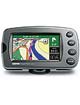
StreetPilot 2720
City Navigator Europe NT (preloaded)
MapSource® City Navigator Europe NT DVD
12-volt power cable with external speaker
Alphanumeric remote control
USB cable
AC power adapter
Beanbag mount
Dash mount
Protective cover
Owner’s manual
Quick reference guide
|
| |
Specificatii
Storage: Internal flash memory comes preloaded with City Navigator™ NT, providing street-level detail and addresses, plus listings of nearby restaurants, hotels, ATMs, etc., throughout the U.S., Canada and Puerto Rico
Custom POIs: Add your own restaurants, safety cameras and other points of interest to the preloaded map. Proximity alerts warn of upcoming custom POIs, such as safety cameras or school zones
Map scale: Screen-width scale 900 feet to 6,100 miles
Map Orientation: 2D or 3D
Navigation features Routes: Automatically calculated with turn-by-turn instructions; up to 50 stored routes; each stored route can contain multiple VIA points, which can be auto-arranged to minimize trip distance; a detour function enables routing around traffic problems or road construction (using optional GTM 10 FM Traffic Receiver)*; custom road preference allows user to prioritize choice of back roads or major highways; automatic off-route recalculation shows how to get back on track if you miss a turn or exit
Voice: Text-to-speech capability offers more specific voice guidance cues
Waypoints: 2000 with name and graphic symbol
Track log: 2000 track log points
Trip computer: Resettable odometer, timers, average and maximum speeds
GPS performance Receiver: WAAS enabled;12 parallel channel GPS receiver continuously tracks and uses up to 12 satellites to compute and update your position
Acquisition times:
Warm: Approximately 15 seconds
Cold: Approximately 45 seconds
AutoLocate®: Approximately 2 minutes
Update rate: 1/second, continuous
GPS Accuracy:
Position: 15 meters (49 feet), 95% typical**
Velocity: 0.05 meter/sec steady state
GPS (WAAS) Accuracy:
Position: <3 meters, 95% typical
Velocity: 0.05 meter/sec steady state
Interfaces: USB 2.0 full speed device
Antenna: Built-in patch; MCX-type connector for optional external GPS antenna connection
Physical Size: 5.6” W x 3.2” H x 2.0” D (14.3 x 8.0 x 5.0 cm)
Weight: .93 pounds (420 g)
Display: 3.8” WQVGA; 454 x 240 pixels; bright, automotive-grade color TFT with automatic dimming backlight and touch screen
Infrared: Remote control, IR port
Photo sensor: Senses lighting conditions for automatic backlight dimming
Case: Rugged; fully gasketed
Temperature range : 5°F to 158°F (-15°C to 70°C)
Data storage: Indefinite; no memory battery required
Map storage: Preloaded internal storage
Power Input: 12v DC
Usage: 12w max. @ 13.8v DC
Specifications are subject to change without notice.
*Traffic services available only in select cities where “RDS TMC” coverage exists. Requires GTM™ 10 FM traffic receiver and subscription fee in some areas to enable traffic capability.
**Subject to accuracy degradation to 100m 2DRMS under the U.S. Department of Defense
|


